
Work Smarter
Everyone wins when the job is done right the first time. You're dollars ahead when you (and the operator) know what's happening before a machine ever shows up at your site. That's why we've invested in professional grade surveying equipment, data processing software, CAD programs, and machine control.
Everyone wins when the job is done right the first time. You're dollars ahead when you (and the operator) know what's happening before a machine ever shows up at your site. That's why we've invested in professional grade surveying equipment, data processing software, CAD programs, and machine control.
|
Survey
Our hand held survey unit allows for precise reading of defined points, such as control points, survey markers, and culvert inverts. The same system mounted on a side by side allows for efficient surveying of larger areas. And for the best results over large areas, we have a drone for aerial surveying. All our survey equipment ties together, capturing data in either near absolute position, or snapped to an existing setup. 
|
Map
View your project in elevation-exaggerated 3D for a quick overview. Study a contour map for a more in depth view. Compare that contour map to posted heights of culverts, historic flood levels, or other objects of interest. See sample maps. 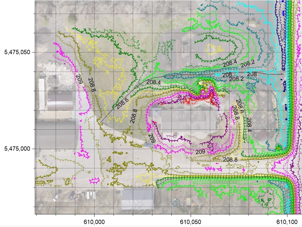
|
|
Analyze
How much cut is needed to drain that puddle? Is the culvert low enough, or should the puddle be filled instead? How many trees will need to be removed to build a driveway at flood level? Which is the best direction to slope this gravel pad? Don't guess. We'll analyze your project and give you the numbers. 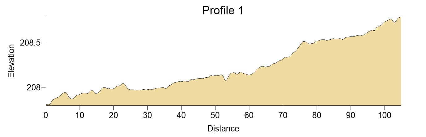
|
Design
We can help you design your project, making sure volumes balance and the site drains to the intended location. We can also build a digital project from a blueprint. 3D modeling your project can provide proposed excavation volumes before work starts, as well as giving real time cut and fill numbers to our operators. See a proposed sub development model. 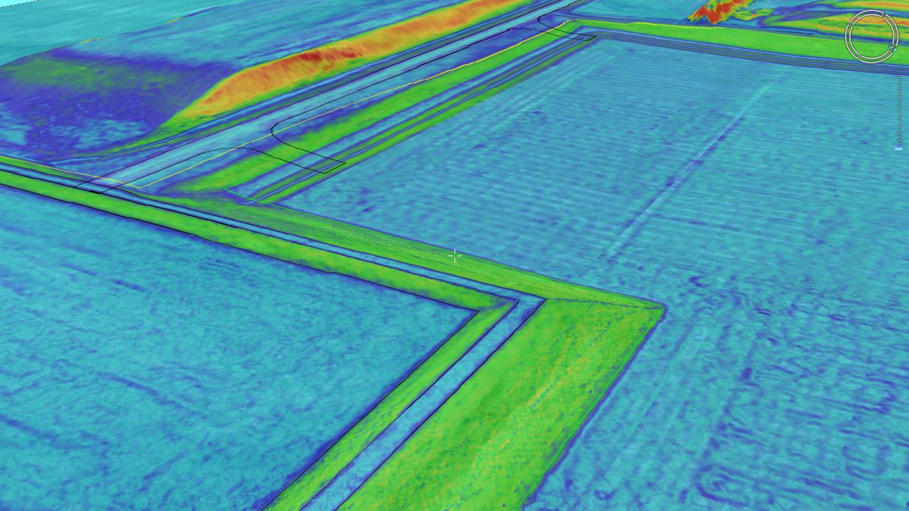
|